Understanding the Basics of Trail Map
Whether you’re an avid hiker, nature enthusiast, or just someone looking to explore the great outdoors, understanding how to use a trail map can profoundly enhance your experiences. Trail maps are essential tools that help navigate various terrains, ensuring you stay safe while discovering new paths. This section delves into the fundamentals, explaining what a trail map is, its significance for outdoor activities, and the features that distinguish a quality trail map.
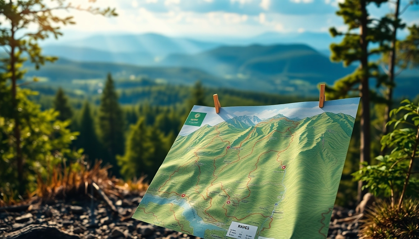
What is a Trail Map?
A trail map is a visual representation of a specific hiking or biking route in natural areas. It illustrates the terrain, pathways, landmarks, and other significant elements that a user may encounter when traversing a trail. Typically, trail maps include features such as elevation changes, water sources, and points of interest, which can range from historical sites to scenic viewpoints.
Importance of Trail Maps for Outdoor Activities
The significance of trail maps cannot be overstated, as they serve multiple purposes:
- Navigation: Trail maps provide crucial information about your surroundings, helping you to stay oriented while exploring new paths.
- Safety: Knowing where you are and the nature of the terrain can prevent you from making misinformed decisions that could lead to dangerous situations.
- Planning: With a clear depiction of trails and their features, users can select routes that match their skill level, time constraints, and desired experiences.
- Enhancing Experiences: By identifying unique landmarks and scenic viewpoints, trail maps can guide users toward memorable experiences in nature.
Key Features of a Good Trail Map
A high-quality trail map usually contains certain key features that make it effective:
- Topographical Details: Elevation lines and landforms help the user understand the anticipated challenges they may face.
- Trail Designation: Different trail types (e.g., hiking, biking) are often marked accordingly to help users choose the right route.
- Landmarks and Points of Interest: Symbols indicating campsites, lookout points, and water sources enrich the user’s understanding of the area.
- Scale and Orientation: A scale bar and a clear North indicator help users establish distances and directions accurately.
Types of Trail Maps
Trail maps come in various formats, each designed to cater to specific needs and preferences. Understanding the types can assist you in selecting the appropriate map for your next adventure.
Topographic Trail Map
Topographic trail maps depict elevation changes through contour lines, providing an accurate representation of the terrain. This type of map is ideal for experienced trekkers who need to understand the vertical challenges of a trail. The detailed elevation data helps hikers prepare for climbs and descents while identifying potential navigational obstacles.
Interactive Trail Map
Interactive trail maps, often accessed via digital platforms or apps, allow users to zoom in on specific areas, obtain real-time information, and track their location. Features may include user-generated content such as reviews and images that enhance the contextual understanding of a trail. These maps are particularly useful for planning and navigating because they adapt to the user’s needs dynamically.
Printed vs. Digital Trail Maps
Both printed and digital trail maps have their advantages:
- Printed Maps: These are reliable in areas with limited cell service and can withstand adverse weather conditions, making them a dependable option for off-the-grid expeditions.
- Digital Maps: Digital versions often feature updates, interactive elements, and customizable options, allowing users to have a more tailored experience. They also provide access to real-time GPS tracking, which can significantly enhance navigational precision.
How to Read and Interpret Your Trail Map
Knowing how to read and understand a trail map is crucial for a safe and enjoyable outdoor experience. This section explores the essential skills needed to interpret various aspects of a trail map.
Recognizing Symbols and Markings
Every trail map employs a standardized set of symbols and markings to convey information. Familiarizing yourself with these is crucial:
- Trail Markers: Different colors or styles may indicate trail difficulty level (e.g., easy, moderate, difficult).
- Landmarks: Icons for campsites, viewpoints, and amenities help in orientation and planning breaks.
- Topographical Indicators: Contour lines and shading signify elevation, providing insights into the trail’s steep sections.
Understanding Elevation and Terrain
Adeptly interpreting elevation changes is vital for anticipating the physical demands of a trail. Maps will often depict elevations at specific intervals; understanding the gradient, particularly in relation to your capabilities, can guide your preparations and pace.
Using Trail Maps for Safety Precautions
Safety is a primary concern when navigating outdoor environments. Use trail maps to assess:
- Possible Hazards: Identify potential dangers such as steep drops, water bodies, or difficult terrain.
- Rescue Points: Maps often highlight locations where help can be accessed, which can be critical in emergencies.
- Exit Routes: Knowing alternative ways down can save time if conditions change or fatigue sets in.
Technology and Trail Maps
In today’s digital age, technology has revolutionized how we interact with trail maps. This section examines the integration of technological tools and their benefits.
Apps and GPS Integration
Many mobile apps make hiking more accessible by offering integrated GPS functions alongside trail maps. GPS technology allows hikers to track their progress in real time, making navigation easier and more precise. Many apps can also provide contextual data, such as weather updates, trail conditions, and user comments about specific stretches along the route.
Benefits of Using Technology with Trail Maps
The incorporation of technology in using trail maps leads to multiple advantages:
- Increased Accuracy: Technological tools enhance positioning accuracy and allow users to precisely track their route.
- Ease of Use: Interactive features simplify navigation, making it accessible to less experienced hikers.
- Community Engagement: Users can share experiences, tips, and updated trail conditions, fostering a sense of community among outdoor enthusiasts.
Offline Maps: What You Need to Know
Offline maps are essential for hiking in areas with limited connectivity. Before heading out, ensure you download necessary maps or bring a physical version. Offline maps provide the same benefits as their digital counterparts without relying on the internet, making them indispensable for remote adventures.
Best Practices for Utilizing Trail Map in Adventures
To maximize the benefits of trail maps during your outdoor adventures, consider the following best practices.
Planning Your Route Using Trail Map
Effective route planning is crucial for a successful outing. Here are strategic tips for planning:
- Assess Your Skills: Choose routes that match your experience level and physical capabilities.
- Review Trail Conditions: Check for any reported issues or closures on your selected trails.
- Time Estimation: Calculate the expected time for each segment of your journey to avoid getting caught out after dark.
Trail Etiquette and Conservation
Practicing good trail etiquette and conservation is vital in preserving nature for future visitors:
- Leave No Trace: Always follow the principles of minimal impact to protect the environment.
- Stay on Designated Trails: Avoid creating new paths to maintain natural habitats and prevent soil erosion.
- Be Courteous: Yield to others, allowing faster hikers to pass and maintaining a respectful distance from wildlife.
Staying Safe While Navigating with Trail Map
Safety considerations should never be overlooked when hiking. Implement these strategies:
- Check Weather Conditions: Always review the weather forecast and be prepared for sudden changes.
- Travel in Groups: Whenever possible, hike with others to ensure added safety and support.
- Pack Essentials: Bring adequate supplies, including food, water, a first-aid kit, and a means of communication.


Leave a Reply